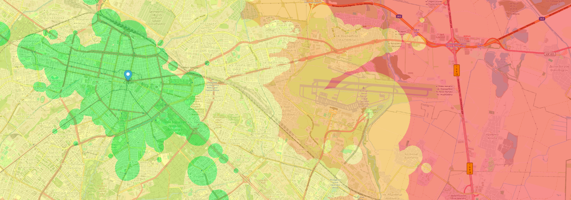
How to Read the Map
With a single starting point, set one location and click Apply.
The map fills with colored zones - each color is a travel-time band from the
Categories legend. For example, green might mean up to 15 minutes from your start.
Those bands are journey duration (walking, waiting, riding, and transfers),
not the clock time when you would arrive.
With multiple starting points, add two or three locations, then click Apply.
The map shows only areas that fall in the same travel-time category from every location -
useful for meetups, shared commutes, or comparing where everyone can reach equally well.
Change the day, departure time, or locations any time and apply again to refresh the map.
Example Scenario
Starting point: your home (set on the map)
Day & departure: Tuesday at 09:30
Legend category: green - up to 15 minutes
Areas in that band take about 15 minutes to reach from home by public transport
when you leave at 09:30 on Tuesday - including walks and transfers.
Note: Colors show how long the trip takes; they are not arrival times on the clock.