Plan your journeys quickly, conveniently, and with confidence. See how long it takes to reach the city center from anywhere using public transport.
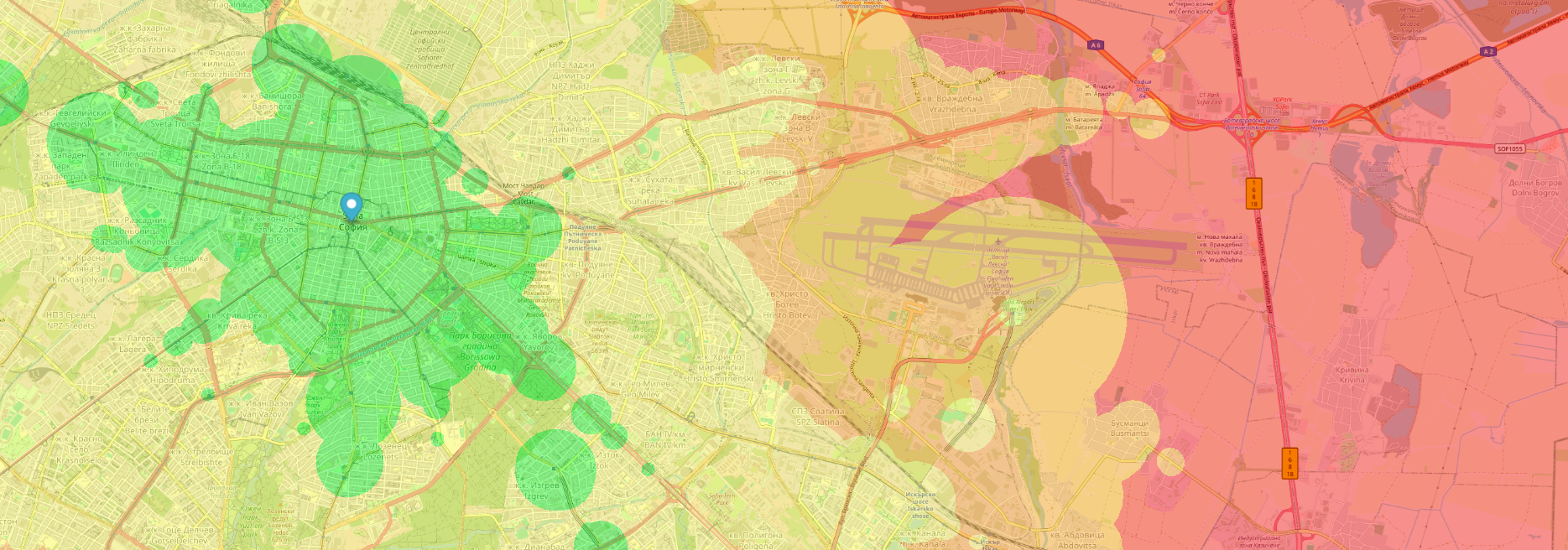
Travel Time Categories
* Time intervals are dynamic and customized for each city's size.
The application visualizes the time needed to reach the city center using public transport, combining official timetable data, transfers, and walking segments. The map displays different zones color-coded according to the approximate travel time, making it easy to compare the various areas.
Green areas are quick to access, while red areas take longer. Instantly compare different neighborhoods visually.
Select a specific day of the week and a departure interval to receive a realistic estimate based on the current schedule.
We don't just calculate bus speed. We include the walking time to the stop, transfers, and the final walk.
The departure time window represents a period during which your trip can begin at any moment. The displayed travel time to the city center is the duration of the trip itself, not the time from the beginning of the window to your arrival.
This helps you plan your journeys quickly, conveniently, and with confidence.
Window: 09:00 β 10:00
Result Reported: 15 minutes
This means the optimal trip starts within your window (e.g., departing at 09:30) and arrives 15 minutes later (at 09:45).
Note: The trip may extend beyond the end of the window (arriving after 10:00), as long as the departure occurs within it.